Western
National Parks
Minnesota, Nebraska, South Dakota,
Wyoming, Montana, Washington, Oregon
Travels from
Minnesota
through the Western National Parks: October
1 to October 18
(Pictures are
thumbnails. Click on them for a larger view. You may click on the subjects
listed to go directly to them.)
Subjects:
Travels to Nebraska
Bowring Ranch / Wounded Knee
Mt. Rushmore
Custer State Park
Crazy Horse Monument
Through Wyoming
Yellowstone
Fly Fishing
Through Washington
Mt. Saint Helens
Marbles in Lake Oswego
This update finds the Rich Family traversing the U.S. from
Minneapolis all the way to Lake Oswego near Portland, OR. The trip went
directly to Battle Creek, NE on business to form a partnership between Pinnacle West Corporation, Denny's company,
and the BEST bank in all of
Nebraska, probably the entire U.S. for that matter: Battle
Creek State Bank. See the update for a picture of this great
bank.
From that point, the Riches wound their way north and west
to see spectacular Western scenery and some great National Parks and Monuments,
most notably, Yellowstone National Park. Traveling later than the peak
tourist season is great, in that there are fewer tourists to impact our
experiences. However, October weather is something to be
considered. The Rich Family Odyssey has been blessed with good weather
everywhere we have gone, with a minor exception in Mt. Rainier National Park,
which was mostly IFR all the way.* Anyway, enjoy the pictures and dialogue. If you
have questions, or would like to send us a message, DON'T HESITATE, and click
on: Send
e-mail.
|
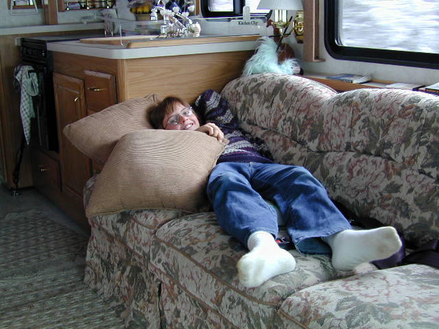
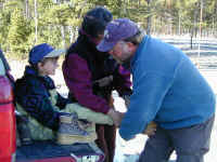
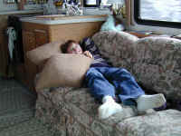
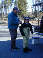
One of our favorite days
was one of fly fishing in Yellowstone National Park on the Firehole River.
Jennifer was already a fly fishing 'expert' but Stephanie and Denny needed some
lessons. Here is Stephanie getting outfitted with her gear with help from
Mom and our great guide, Chuck. Stephanie got her boots on over her waders
and learned quickly how to cast a fly rod. She caught the two biggest
Rainbow Trout of us all! Of course, like all good fly fisher-people, we
released all the fish we caught (this is the law in Yellowstone) to grow and be
caught another day.
|
Stephanie has written an informative paper on
Yellowstone National Park. Click on Schoolwork
to read her report and see a few more pictures. She did a great
job in researching and reporting on the first National Park, Yellowstone.
Latest maps can be seen by clicking on
New Maps. Previous
maps are archived to make downloading easier.
* IFR means "Instrument
Flight Rules", pilot-talk for conditions when you can't see much through
the clouds. Special safety and orientation instruments in the cockpit help you
travel safely...in this case it was those shiny yellow lines on the road!
Back to Top
Travels
to Nebraska

Once we left Minnesota, Jennifer detoured
us through Northwest Iowa to visit a lovely place called Spirit Lake, which you
see in the background. Actually, it was not so spirited or clear due to the fertilizers that the farmers now use wash into this lake causing a very large
algae bloom making the edge of the lake very gooey and green. Because of this,
people there actually hoist their docked boats out of the water to escape the
algae. Later, we went through a nice tourist town and larger lake near
there called Okiboji Lake, which was very clear and quite nice.
If you click on the next picture, you will see more clearly see Denny's sister and
business partner, Nancy Harmon, standing in front of Battle Creek State Bank in Battle Creek, NE. This is the best bank in
all of Nebraska and a new partner for Pinnacle West. The next picture
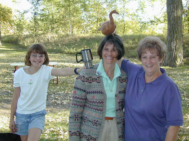
shows Stephanie, Nancy and Jennifer celebrating Jennifer's birthday party in
Norfolk, NE which is where we stayed while visiting Battle Creek.
Norfolk (best known as Johnny Carson's hometown) is 13 miles east of Battle Creek, NE and has a
very nice public campground.
Back to Top
Bowring
Ranch / Wounded Knee
As we traveled along the way to our
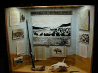
destinations in the west, we made a few interesting side trips. One was to
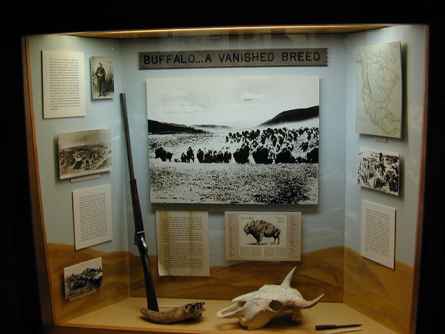
the Bowring Ranch in northern Nebraska, which is a place where they have captured a lot of the history
of the early west and kept the ranch intact much as it was at the turn of the
20th century. In the museum, there is a display shown in the next picture
depicting the killing of the hundreds of thousands of buffalo (or, more accurately, bison)
that roamed the plains in the
nineteenth century to the point there were only a few hundred left. Not a great
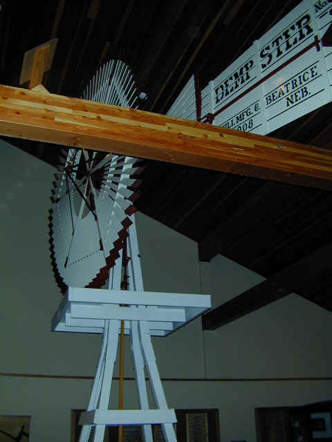
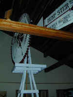
tribute again to the white man. Stephanie took a picture of a well painted
windmill that was used to pump water. Other windmills would be used to
generate electricity for charging batteries to keep houses and henhouses lit
with bright light.
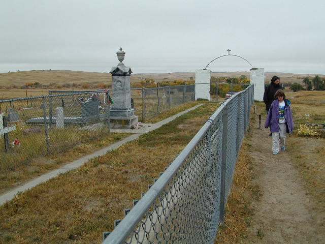
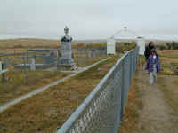
Wounded Knee, SD is the place that in 1890 the U.S. Army killed between 150 and
300 unarmed Indian men, women
and children when they were trying to contain the Indians and settle them on to
reservations, usually in Oklahoma. In this case, a shot rang out from an
unknown person, causing panic. The soldiers began firing at the Indians
indiscriminately and killed many. This picture shows the mass grave and memorial
to those Indians who died. This was truly the Indians 'last stand' and
very sobering.
Back to Top
Mt.
Rushmore
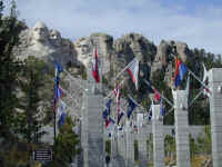
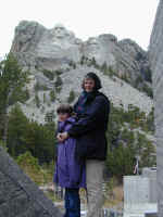
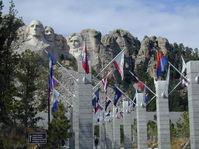
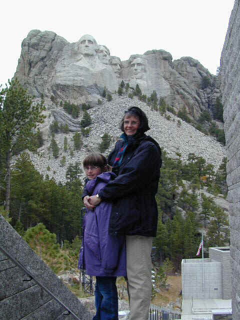
One of America's favorite memorials is Mt.
Rushmore, outside Rapid City, SD. The memorial, sculpted by Gutzon Borglum in the
1930s and 40s shows four presidents: George Washington and Thomas Jefferson as fathers
of our country, Abraham Lincoln as the President who kept the nation intact, and
Teddy Roosevelt as the president who had the vision to lead us into the
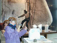
twentieth century as a world leader. A new visitors center has been built
in the last few years and is quite informative and spectacular (showing flags of
all US states and territories), in addition to
the monument itself. Inside the visitors center, Stephanie gets some instructions on carving stone,
much like the monument would have been carved. Jennifer and Stephanie pose
at the base of the mountain. It really is something to see up close.
Back to Top
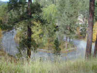
Custer State Park
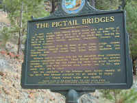
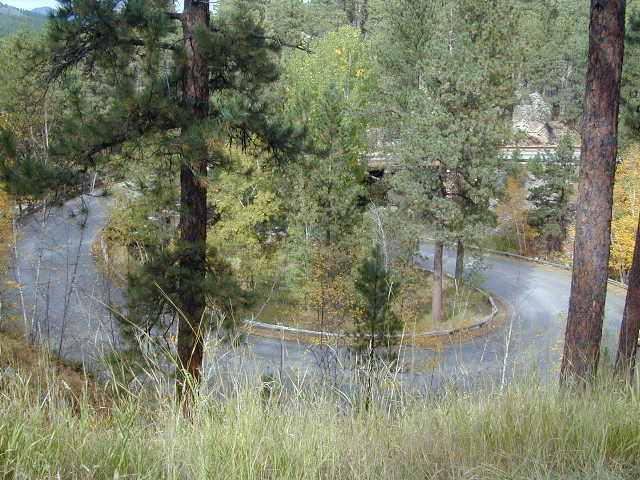
We traveled from Rapid City along a route
through Custer State Park. Along the road, we encountered some terrific
engineering in a series of bridges that crossed back on themselves, called
Pigtail Bridges. If you click on the picture of the historical sign, you
can read about how C. C. Gideon created them.
The pictures below show some of the wildlife that we saw on our trip through
Custer State Park. It was quite a display and the most fun we had on our
trip viewing wildlife.
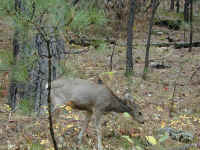

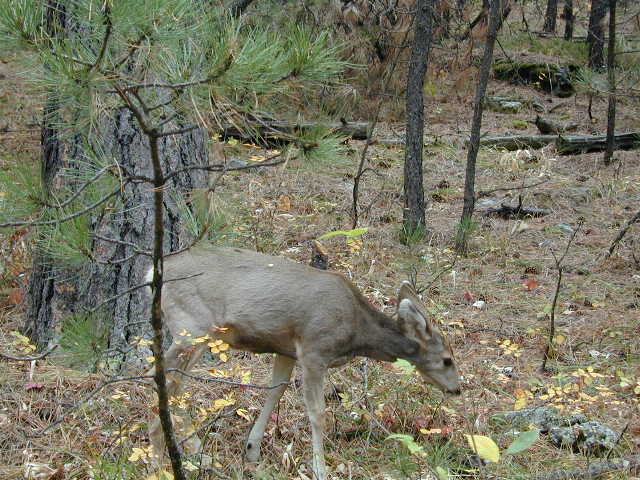
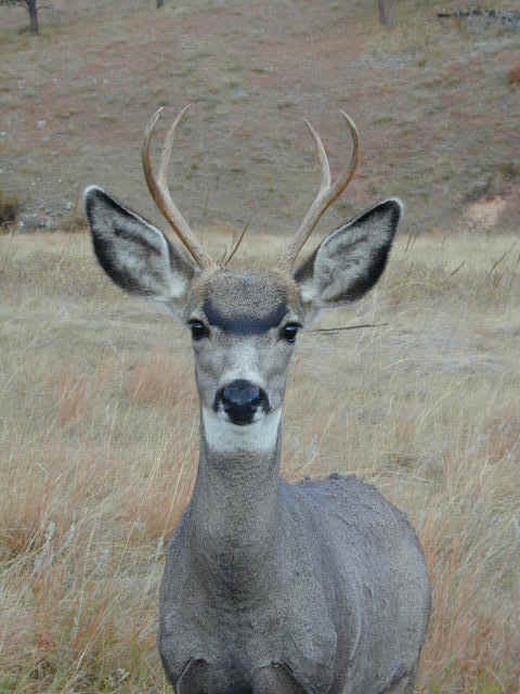
The first picture is of a little doe mule
deer (notice the big ears, hence the name) which we saw many of. Next, you
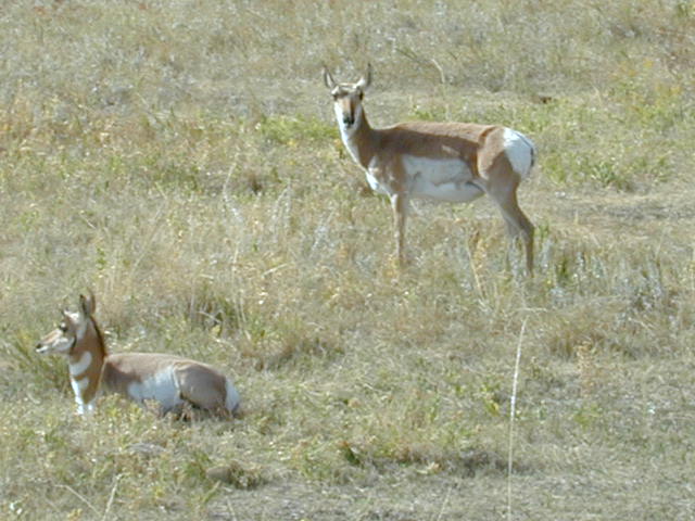
can see a herd of wild donkeys. Then we had an opportunity to see and
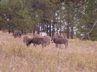
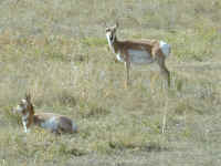
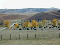
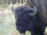
photograph many, many antelope sitting and grazing near the road. South
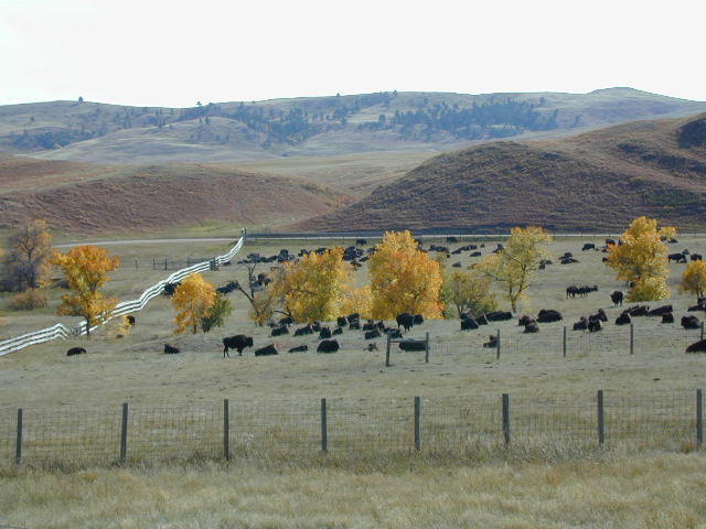
Dakota's large buffalo herd (as seen in Dances with Wolves and other
western movies) roam here and are shown in a corral after the annual fall roundup
the week before. The park sells some of the buffalo to help
provide funds for the park and to keep the buffalo herd size managed. Some
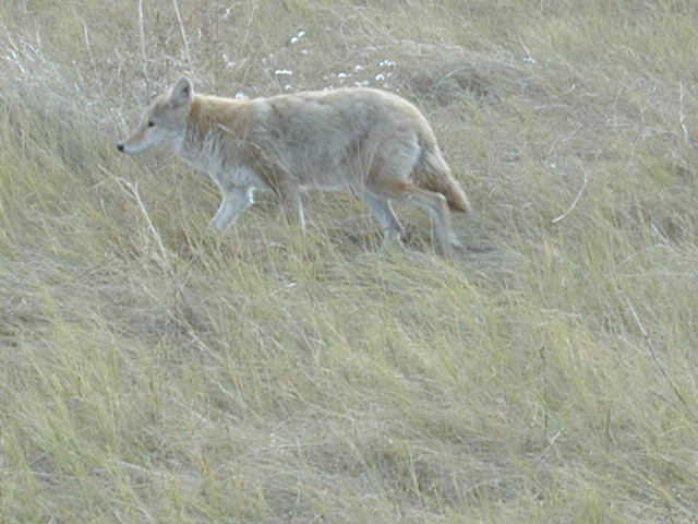
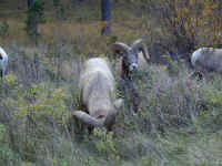
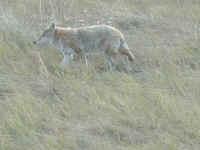
big horn sheep hugged the road. Even a wily lone red coyote was traversing
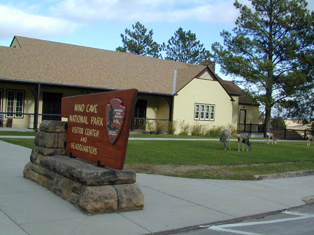
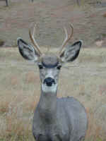
the grass near us. Finally, you can see that the mule deer are so
plentiful that they even come right down to the visitor's center at Wind Cave
National Park and eat the grass. A small buck poses for the camera
thinking we might give him something to eat. We didn't.
Back to Top
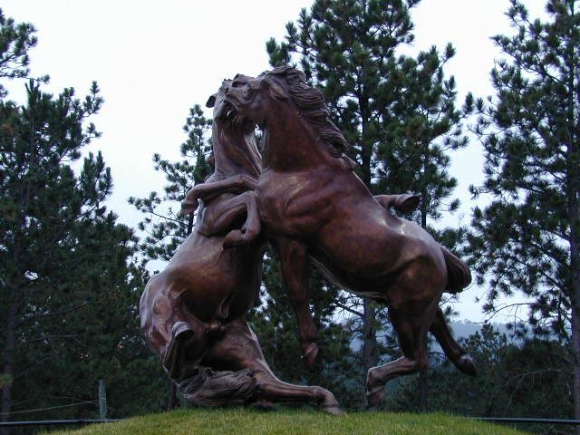
Crazy Horse Monument
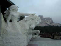
Following our tour of Custer State Park, we
made a side trip and a stop to visit the ever growing Crazy Horse
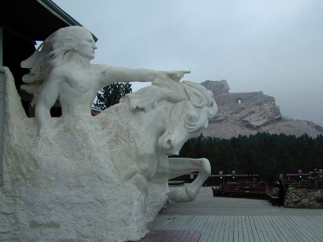
Monument. The picture shows the model that the sculptor, Korczak
Ziolkowski, made to show how the very large mountain monument would look when
finished. You can see the mountain in the background with the
completed head and the start on the pointing arm (actually larger than a
football field). Ziolkowski died a few
years ago, but his wife and 8 of his 10 children are working full time to
complete the mountain monument, commissioned by an organization of Indian
tribes. There is no target completion date, but
real progress is being made, all without a single dollar of federal or state tax
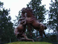
money to help. The fighting stallion horse sculpture is one of
Ziolkowski's most famous and is displayed at the monument.
Back to Top
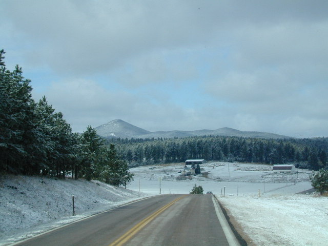
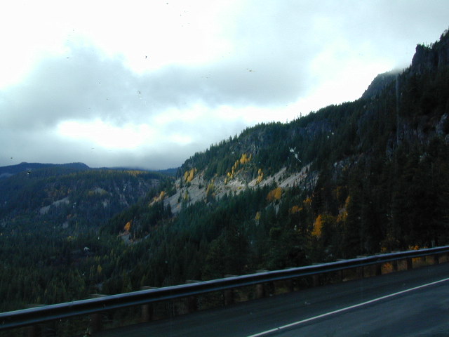
Through Wyoming
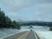
As we left Rapid City and traveled through
the Black Hills on our way to Wyoming, we encountered the first of the winter
snow falls. It was quite gorgeous, as you can see. Betty, our RV, and our Jeep, in tow, get very grimy while
traversing through some sloppy snow left on the road. Washing becomes a
frequent necessity this time of year!
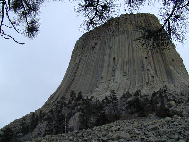
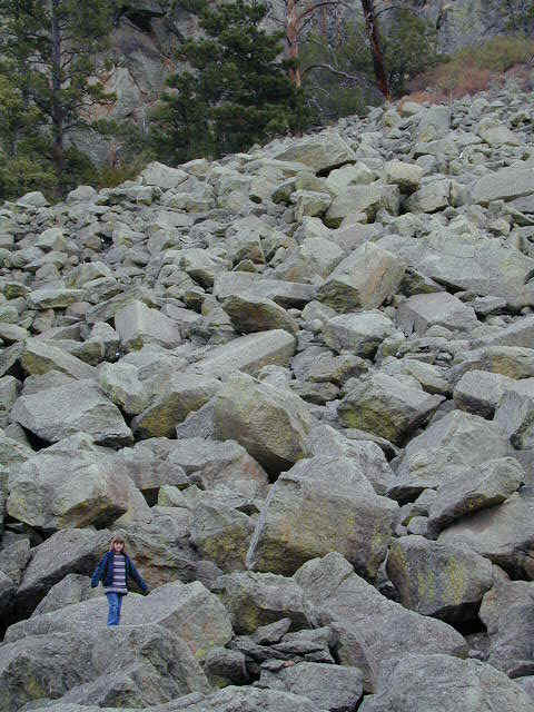
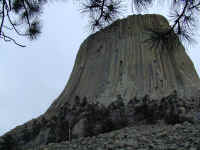
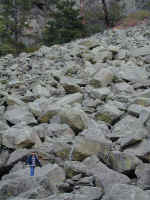
Next, you can see a picture of Devil's Tower National Monument in eastern
Wyoming. After becoming famous in the movie, 'Close Encounters of the
Third Kind,' it was really great to see it up close, and from the bottom instead
of the usual views from a distance. The next picture shows Stephanie on
the rock field below the monument where rocks have fallen off over the millennia.
When you go there, read about the Indian legend of the giant bear who scraped the tower with his
claws chasing his Indian prey.
Here is Steffi in a normal pose while we
travel down the road. The only thing missing from her is Java, our cat,
who is usually in her arms in this pose.
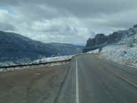
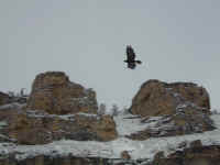
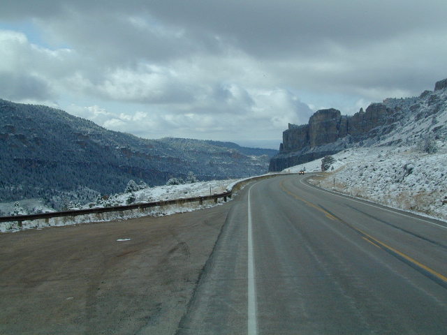
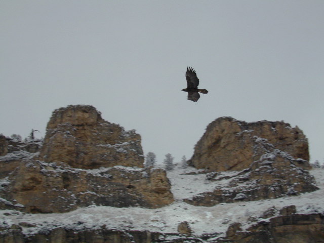
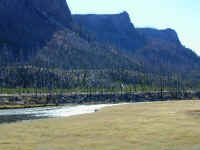
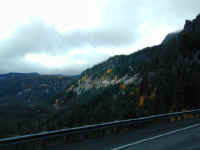
As we passed through some fabulous Wyoming
scenery on our way to Yellowstone, we got many views of some fabulous canyons
and rock formations. This is shown as we traveled west from Buffalo, WY
through Tensleep Canyon. Amazingly, an eagle (we think) flew right along
Betty while we went through the canyon for a half mile of so. We had time
to snap a few pictures of him/her alongside.
Back to Top
Yellowstone
Having made our way through Wyoming to
Yellowstone, we had a fabulous time touring and seeing a lot of gorgeous
scenery, geological sites, and great wildlife. We assume most of you
reading this have been to Yellowstone, so we are not going to publish a ton of
pictures. Stephanie has written a wonderful paper which is published in
her
Schoolwork
section. If you haven't been there, GO! We highly recommend
September or, in our case, October, because the crowds are mostly gone and all
the good things are left, including fall color!!
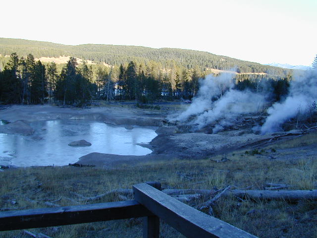
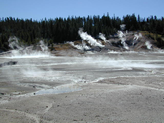
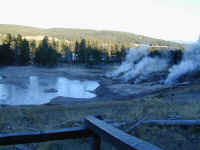
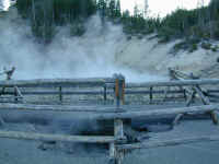
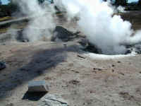
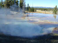
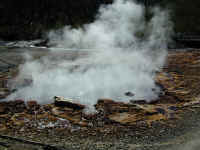
The first two shots show
some typical hot springs and fumaroles, with the second picture showing how
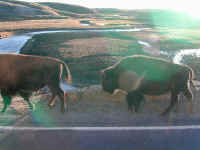
Yellowstone changes all the time, including making new hot spots in the parking
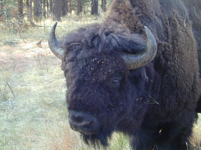
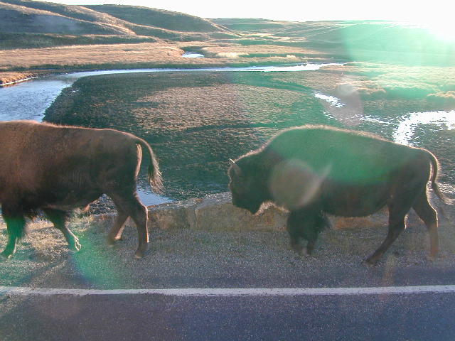
lot. Buffalo are everywhere, but not usually crossing the road as you see
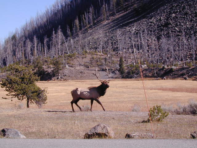
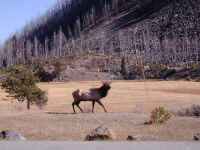
here. A large bull elk, in rutting season, is seen here going after quite
a few cows that are busy crossing the Madison river shown in the next
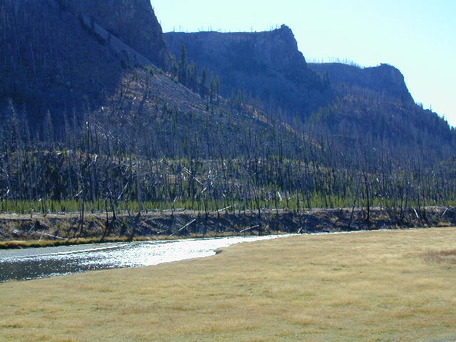
picture. Notice how much the new growth of Lodgepole Pine is seen under
the burned trees from the 1988 Yellowstone fires. There are so many, it
looks like they were planted, but they were not. It is just Mother Nature
doing her work.

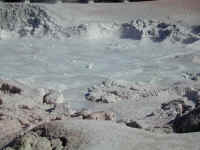
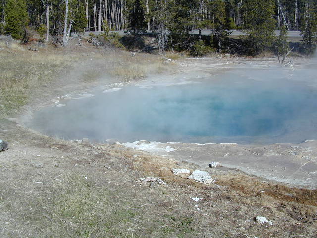
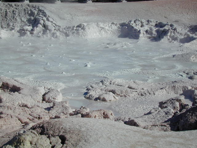
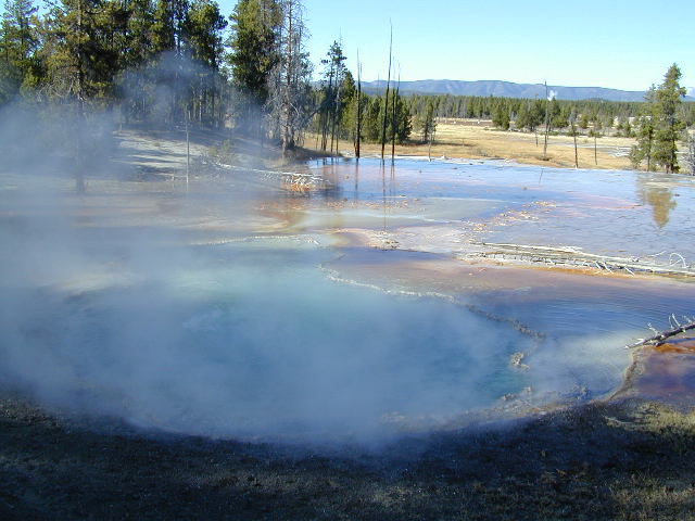
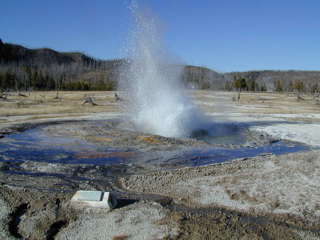
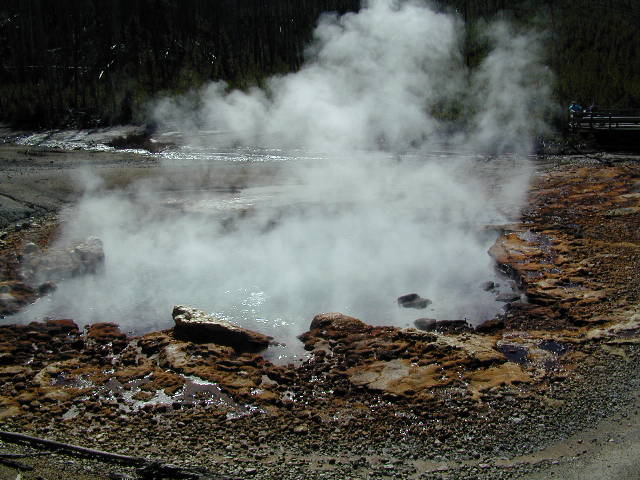
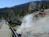
The first picture is of Celestine Pool in
the Fountain Paint Pot area. Next picture is a typical mudpot which
looks exactly like like gray boiling paint. Next Red Spouter's fumarole is also a red mudpot in the spring when the water table is
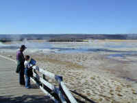
higher. Stephanie and Denny overlook some hot springs in the Lower Geyser
Basin and see a typical geyser erupting continuously. The last picture
shows the color of many of the hot springs as a brilliant blue.


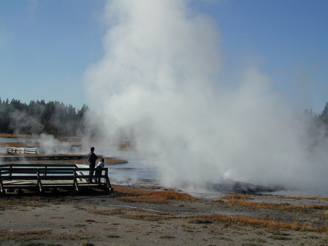
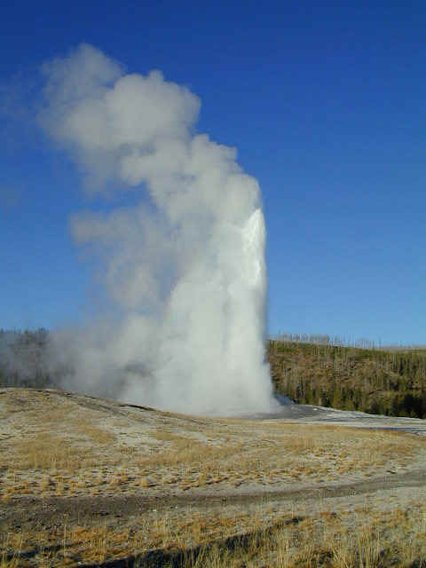
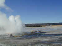
Here are a couple of geysers in the Lower
Geyser Basin followed by a shot of the famous Old Faithful Geyser, which erupts
every 85 minutes or so with a large amount of water. Not shown are the
large crowds gathered around to watch the event. Even in the fall, there
were probably 300 people watching this.

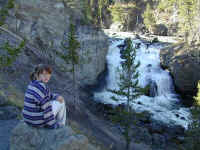
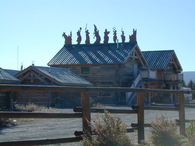
In West Yellowstone, MT there is a set of
cabins that have some great carved figures on top of them. Click on the
picture for a better view. Next, Stephanie sits and watches Gibbon Falls
on the Gibbon River. At Beryl Spring, you can see the 'snow' on the nearby
trees if you click on the picture. It really isn't snow, it is
condensation that has frozen from the steam of the spring. The temperature
was getting down to zero to 10 degrees each night so you can see why the steam
froze on the trees... something you would never see in the summer. At the
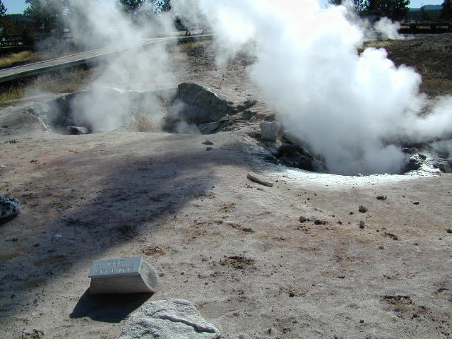
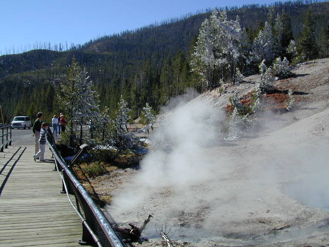
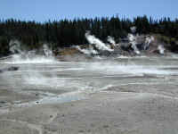
Norris Geyser Basin, you can see all sorts of hot springs and geysers. The first
picture makes it look as if the whole hill in the background is on fire.
The last spring is Echinus Geyser. It erupts every 1 to 4 hours
after the pool fills up. We waited a long time watching the pool fill up,
but finally gave up without seeing the spectacular eruption. Maybe next
time.
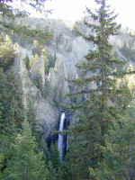
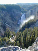
There is also a lot of other beautiful
scenery in Yellowstone. Tower Falls on Tower creek flows into the Yellowstone River. Next is
Lower Yellowstone
Falls as it falls into the Grand Canyon of the Yellowstone.
Back to Top
Fly Fishing


As we said in our introduction, we spent a
day fishing on the Firehole River. We were very busy catching fish and learning
the finer points of fly casting as taught by our guide, Chuck. So, we
didn't have time to take pictures of all the fun in the water, even though we
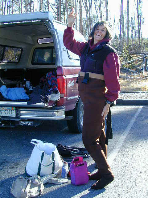
wish we had. Here you can see Stephanie getting her rather large waders
on. Jennifer is happy to be outdoors and ready to fish. Lastly,
Stephanie poses with Chuck back in Yellowstone after a great day.
Stephanie caught two fish, Jennifer caught one, and Denny caught four. We
could have caught a lot more, but learning the fine art of watching the fly for
a hit and then gently setting the hook takes some practice. We will
definitely do more fly fishing in the future... the next time possibly in New
Zealand in January.
Back to Top
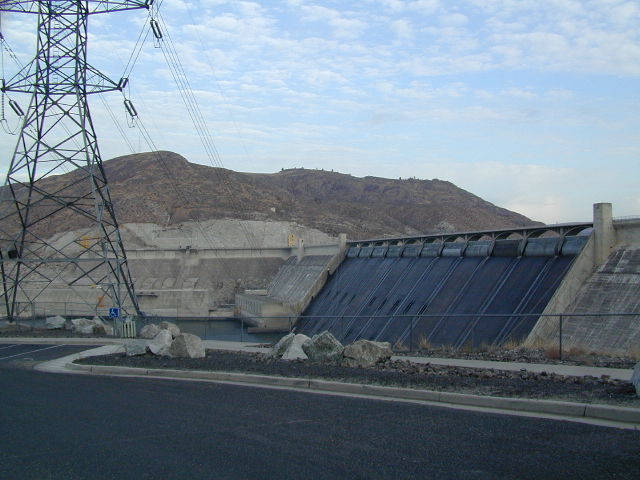
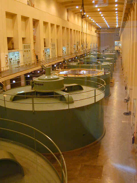
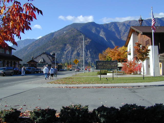
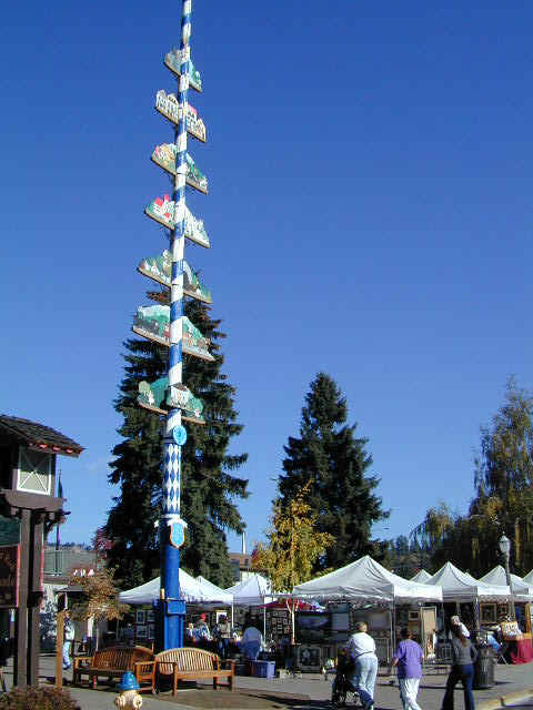
Through Washington

On the way to Oregon, we passed through the
great little town of Sandpoint, ID. Here is a shot inside the terrific
Coldwater Creek store, where Jennifer and Stephanie got a nice shopping
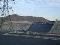
fix. Next, you see the Grand Coulee Dam on the Columbia River in central
Washington. It produces power for over 6 million homes and is used
largely to supplement electricity demand from Chicago to San Diego. The
last picture shows very large pump motors (the power generators look just like
these pumps) which are used to pump water out of the river up to a very large
holding reservoir called Banks Lake which is used to provide irrigation water
for much of central Washington, producer of 75% of the country's apples and
garden seeds.

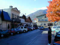
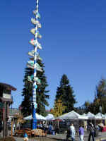
Another nice stop along the way was in
Leavenworth, WA. This is a town that has remade itself from a declining
logging and rail town to a beautiful village in European Bavarian style. It is really
well done. You can see the main street and lastly a May Pole over an art show.
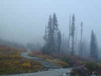
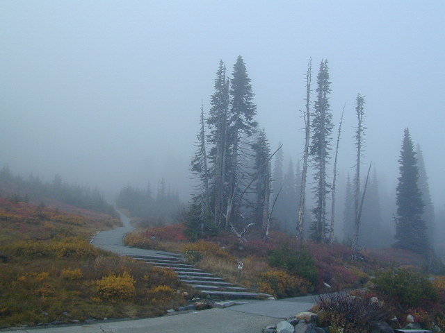
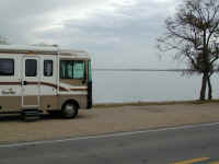
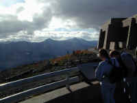
We have had delightful weather for most of
the Rich Odyssey. Very rarely, have we had clouds or rain. However,
on the
day we went through Mt. Rainier National Park, there were lots of clouds
and we could not see the top of the mountain. Nevertheless, the scenery
was great when we were not IFR. The last picture shows the path through
the clouds which leads to the trail to the top of the mountain which is 14,410
feet high.
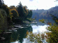
Our campsite near Mt. Rainier was in a
beautiful town called Mossy Rock on Mayfield Lake. Stephanie is enjoying a
nature trail on the way to the lake which was just down the hill from our RV.
Back to Top
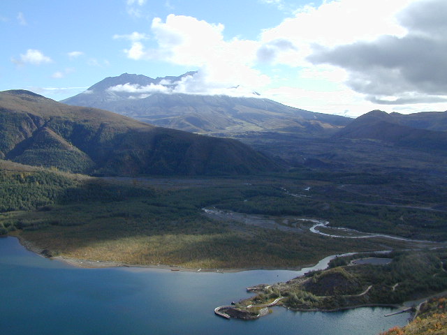
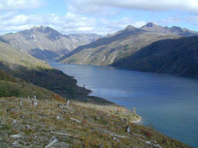
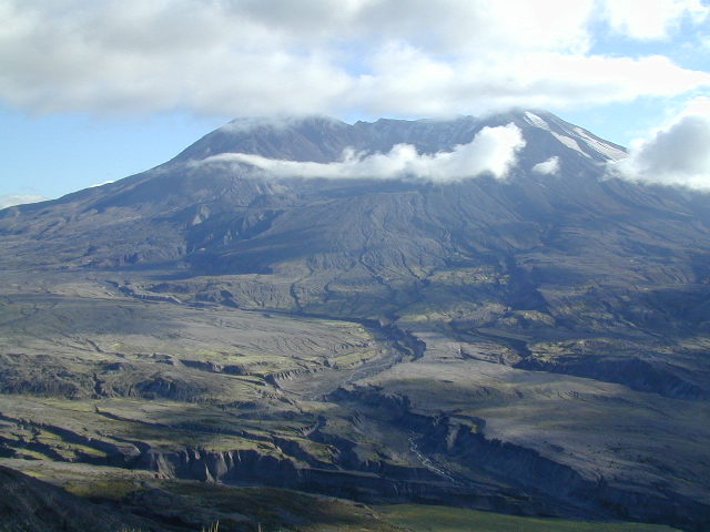
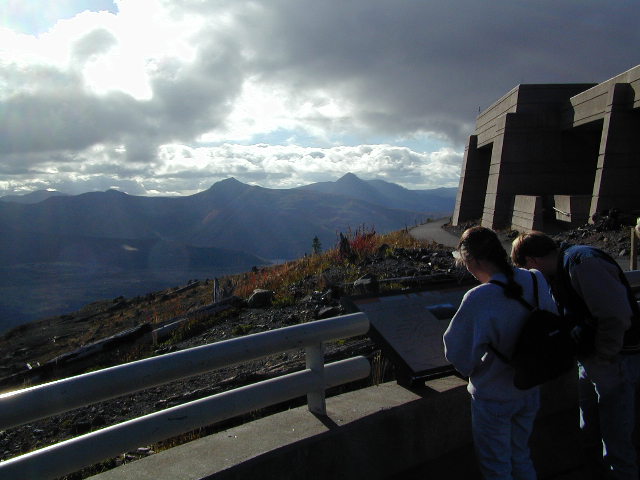
Mt. Saint Helens
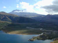

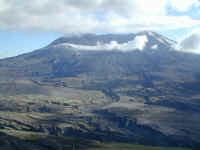
Another fabulous sight along our way was a
visit to the Mt. Saint Helens Volcanic National Monument in southern
Washington. As you may recall, Mt. Saint Helens erupted in 1980 and caused
a major change in the geography around the area especially on the north side of
the mountain which was entirely blown away. In the first picture you can
see the top of Mt. Saint Helens shrouded in clouds and can also see the new
Coldwater Lake which was formed when the mud flow dammed up Coldwater Creek. Another picture of Mt. Saint Helens from the
Johnston visitor's center shown in the next picture. This center was
opened in 1997 and has many informative displays in addition to the spectacular
views up close to the mountain. It is on Johnston Ridge named after a USGS
geologist who was killed there when the mountain exploded. Lastly, if you
click on the picture, you can get a sense of the power of the blast by looking
at the remains of the trees that were once growing everywhere here.
Back to Top
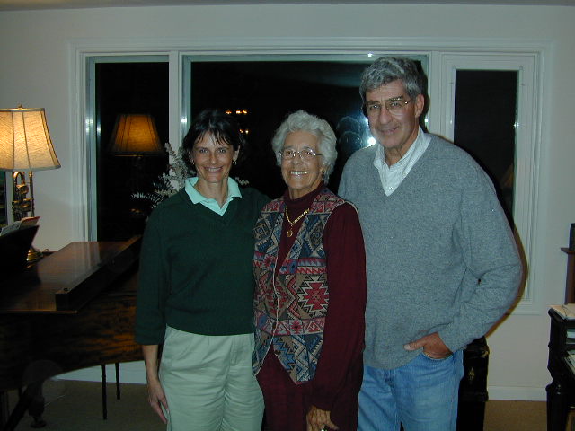
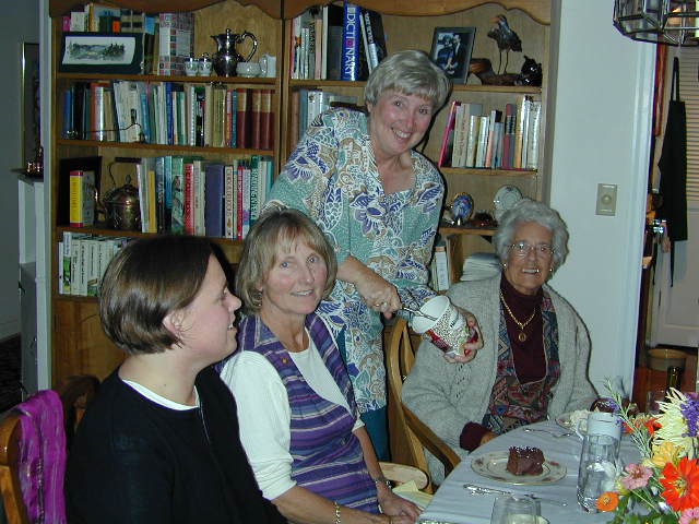
Marbles in Lake Oswego
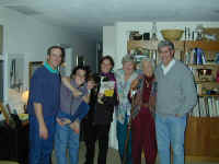

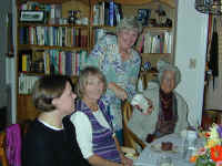
Finally, our arrival in Lake Oswego south
of Portland, OR gave us a few days' respite parked in Jennifer's brother's (Mike and Deb
Marble) driveway enjoying a fine time with them and other friends and
relatives. The first picture shows Denny, Ilene with Stephanie on
her back, niece Abbey Marble, Deb, Nana (Pat) Marble and Mike
Marble. Jennifer, Nana and Mike. Lastly, one of many fine dinners we
enjoyed was a group birthday party for the five fall birthday honorees.
We are now on our way through California
from son Tim's home in San Francisco to sister Nancy Harmon's house in Highland, CA in the LA basin. Then we will turn
east and make some last stops on our way to Colorado. We will be home from
around November 15 to December 1 when we will embark on the around the world
part of the Rich Odyssey. Stay tuned for itinerary updates in the coming
weeks!